
© Railway Wonders of the World 2024 | Contents | Site Map | Contact Us | Cookie Policy


The Canadian Pacific Railway - 2
The road through the mountains
RAILWAYS OF THE COMMONWEALTH -
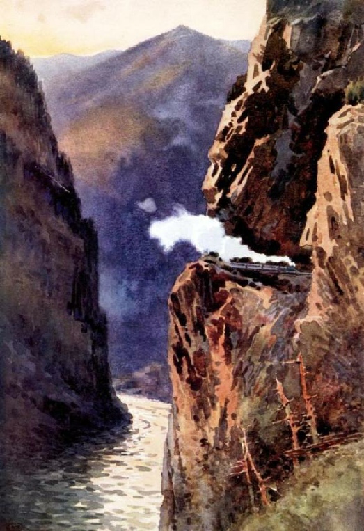
THREADING THE GRAND CANYON OF THE FRASER.
The plotting of the Canadian Pacific Railway through the mountains of British Columbia constitutes one of the greatest achievements of the railway engineer.
FROM Winnipeg westwards the route proposed by Sir Sandford Fleming was abandoned in favour of one nearer the Inter-
Again, it was considered that if the line were placed close to the International boundary it would be impossible for it to be paralleled by a Canadian rival farther south, and thus be in danger of having its traffic filched away by a competitive route. Thirdly, there was the question of expense. The Yellowhead Pass was undeniably the easiest passage through the mountains, but it entailed a sweeping detour, as compared with a more direct traverse of the range, while also heavy and expensive bridging over the wide rivers would be entailed. As money was tight, every mile saved was a vital consideration. Accordingly the fiftieth parallel was hugged as closely as possible as far as Calgary, traversing a rich wheat country for 400 miles, and a grazing belt for 200 miles.
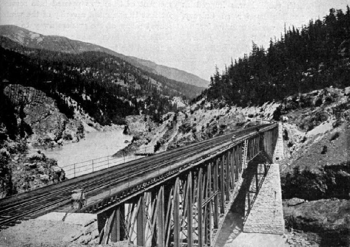
THE BRIDGE OVER FRASER CANYON.
The prairie is considered generally to be a level plain, but this is scarcely a correct appreciation of its characteristics. Rather is it a series of steppes, or very wide benches, mounting higher and higher from Winnipeg to the foothills of the Rockies. The country being analogous to that traversed by the Northern Pacific, the terrors of winter were kept in mind. The Arctic blizzards have a magnificent sweep for hundreds of miles without courting an obstacle, and it was feared that the railway cuttings would be subject to severe attack. Consequently the permanent way was carried on embankments as much as possible, and where cuttings were unavoidable they were given wide, flattened slopes, so as not to offer such a ready catch-
Although the contract for the railway was let to one firm, actual construction was completed by sub-
When the company decided to follow the international boundary as closely a possible, the Government stipulated that the mountains should be crossed at least 100 miles north of the frontier, and at the same time restricted the maximum grade to 116 feet per mile. Accordingly the company decided to strike through the sea of mountains from Calgary, following the natural troughs as much as possible. The surveys proved that the end could be met most satisfactorily and cheaply by following the Bow River. This gave grade of 1 per cent -
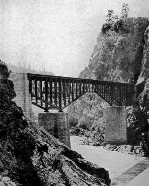
THE CISCO CANTILEVER BRIDGE, SPANNING THE FRASER RIVER.
This is the “Divide”, whence the waters from the glaciers split to run down either side of the mountain on their way to the Arctic or to the Pacific. In reality it is a vast marsh, so that the summit was overcome without a tunnel or even a snowshed. From this point the descent is made along that wild, turbulent waterway which sprawls from one side of the ravine to the other -
Issuing from the Rockies at Golden, on the banks of the Columbia River, another frowning barrier looms directly ahead -
asperating, but that through the Selkirks was a thousand times more so. Here the railway engineers had no trail of the Indian or the coureurs du bois of the Hudson Bay Company to help them. They were compelled to seek a path for them-
An American engineer, Major Rogers, in conjunction with Mr. Moberly, set out to discover a possible highway through this chain, and it proved an exciting and adventurous undertaking. Eight Indians accompanied the first-
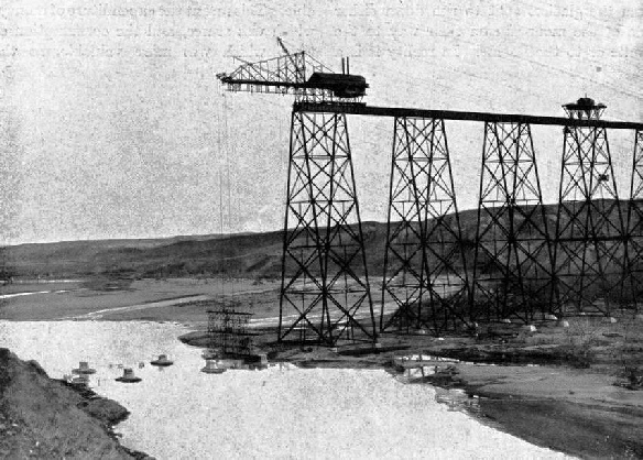
BUILDING THE LETHBRIDGE VIADUCT
Showing erecting cage just commencing work on the span over Belly River.
There was one fact which Major Rogers impressed upon his colleagues on his return. The engineering difficulties were not particularly forbidding, but there was one far more formidable antagonist -
The constructional forces were concentrated upon this range, and were urged to spare no effort to accomplish as much of the grade as was possible during the short summer. The navvies responded to the call, and the permanent way grew with marvellous rapidity. True it was a pioneer line, lightly built, as the problem was to get through with all speed; but it was quite equal to the Union Pacific original track, which had been taken as a standard. When winter came round, work was suspended, but corps of engineers were left buried in the range to observe the extent, character, and paths of the snow movements, so as to enable adequate steps to be taken to protect the line. These men, virtually imprisoned in a white, frigid tomb, carried out their work to excellent effect, although their reports were rather dismaying. Their observations proved that the line would have to be protected virtually for the whole of its length across the range. Four miles of heavy timber snowsheds accordingly were built, not in one continuous length, but in 53 sections. Fortunately, there was plenty of timber in the immediate vicinity, but even then the felling of the trees and the fashioning of the huge balks occupied con-
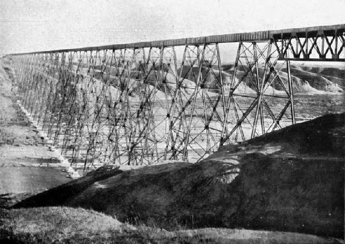
THE LETHBRIDGE VIADUCT, ALBERTA. It is 5,327 feet 7½ inches long and 314 feet high.
Yet this did not meet the situation completely. The snow, after its usual paths had been discovered and guarded, swerved with characteristic capriciousness to strike the line between the different sheds.
Sir William Van Horne, as in many other instances, came to the rescue, and solved the difficulty. He could not anticipate the path of the moving snow, but he could wreck its progress. He devised what is now known as the “split-
Crossing, the summit of the Selkirks at 4,351 feet, the engineers were faced with another sudden descent into the Illecillewaet Valley, which they overcame by a loop winding down the mountain side. It is spectacular piece of work worthy of ranking with the abandoned “Big Hill”. In the course of seven miles the line swings down 637 feet. The line strikes across a valley, touching the base of Rock Peak, bends back for about a mile, gives a sharp sweep, and once more cuts across the rift to pick up the floor of the valley. In the descent the line describes a double “S”, and two gleaming ribbons of steel within 100 feet of one another are seen on the steep slope.
While the builders were pushing their metals westwards another force was grappling with difficulties innumerable in the east-
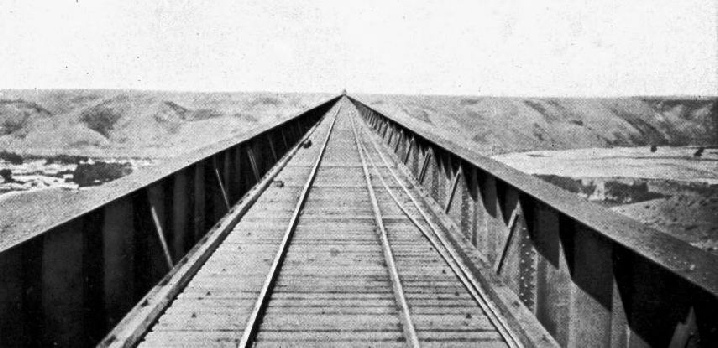
LOOKING ALONG THE DECK OF LETHBRIDGE VIADUCT. Showing girders rising above the rails and forming a trough for traffic.
Labour was a constant anxiety upon this mountain section. White men then, as now, could not be obtained, except at prodigious expense. So the Chinaman was called in, even as had been the case with the Union Pacific. Three shillings a day was his pay, and the grade in British Columbia recalled the roaring times of railway building farther south. The Chinaman is a born and ardent gambler; so no camp was complete without its saloon. A certain degree of lawlessness prevailed and defied to be quelled: it was every man for himself, with life held cheaply, and pleasures of a strenuous character.
But the Chinaman, when he settles down to work, is a plodding labourer. They drove the steel highway through 351 miles of the roughest country in the west, where Nature was dead set against the engineer and did not give him the slightest foothold. It was blast, cut, fill, bridge, and viaduct for every mile of the way, with explosives as the only useful weapons, the roars of which punctuated the interminable chanting of the drills. But on the morning of November 7th, 1885, the roar and clanging ceased. The advancing arm from the Atlantic met that coming from the Pacific: the last spike was driven home by Lord Strathcona; Vancouver was in railway touch with Montreal. By strenuous work, Father Time had been beaten by six years, because the Government contract called for completion in 1891.
Since the first steel trail of the Canadian Pacific Railway was driven across the continent, an alternative route through the mountains has been taken in hand, and is advancing rapidly towards completion. This runs via the Crow’s Nest Pass, some miles nearer the international frontier, through a rich coal region, and crosses the Rockies at a lower elevation. On this section, however, is a notable piece of work equal in magnitude to the realignment of the railway through the Kicking Horse Pass. In running the metals 38½ miles from Lethbridge to MacLeod the deep, wide ravine through which the Belly River winds had to be crossed. When these two points were linked in the first instance, the line was a pioneer road in the true sense of the word, abounding with curves running up to 7 degrees -
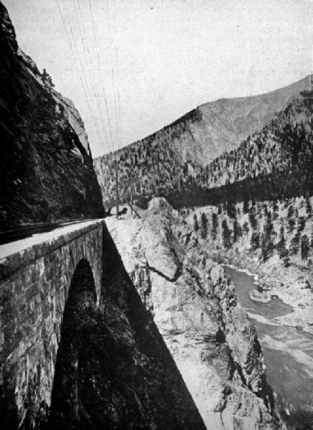
THE “JAWS OF DEATH” BRIDGE IN THE THOMPSON RIVER CANYON.
As the life of the timber trestles had expired, it was decided to rebuild these 38½ miles. Instead of having so many bridges, ranging from 16 to 2,933 feet in length, to cross the depressions, the engineer consolidated them into two big structures, so as to reduce the grade, ease the curves, and decrease the mileage. The bridges constitute the most striking features of this re-
The longer bridge is borne upon 33 lattice steel towers or bents, anchored to concrete plinths carried down to a firm foundation in the silt. The steel was set by means of a traveller which weighed 712,000 pounds in working condition. As the wind howls through this depression with great force, extreme precautions were taken to protect the men on their lofty perches, an assembling cage being supported from the end of the traveller wherein they performed their appointed task of riveting up. In this manner loss of life was minimised, only two men being killed, but not in direct connection with the work. The bridge was completed in a remarkably short space of time, notwithstanding complete cessation during the winter, owing to the extreme cold, and a strike among the workmen. In its construction 12,200 tons of steel were used, which demanded 640 cars to carry it to the site, and when the steel was set over 7,600 gallons of paint were required to give it two coats.
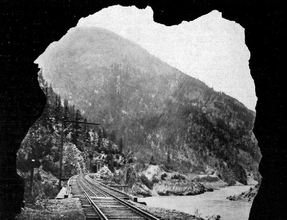
HOW THE CPR MARKS ITS WAY THROUGH THE FRASER CANYON.
Four tunnels are to be seen in this view.
When the railway was opened for through traffic on May 26th, 1887, many critics maintained that the railway would never pay its way. The present prosperity of the enterprise, which now ranks as the largest individual transportation concern in the world, operating some 11,000 miles of line, has refuted the detractors completely. The Canadian taxpayer, however, learned one lesson. He made a present, through the Government, of £14,000,000 made up of £5,000,000 original subsidy, 713 miles of completed line which cost £7,000,000, and a further £2,000,000 in the re-
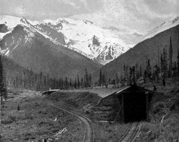
THE SUMMER AND WINTER LINES OF THE CANADIAN PACIFIC RAILWAY THROUGH THE SELKIRKS. The open line is used during the former and the protected metals during the tatter season.
You can read more on “The Canadian Pacific Railway 1”, “The Conquest of Canada”, “The Doorway to Canada” and “The Opening up of Canada” on this website.